제품상세보기
Nautical Publications
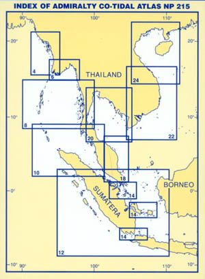
SOUTH EAST ASIA

In this Atlas tidal information is given in the form of Co-Tidal and Co-Range charts and is intended for use in offshore areas and those coastal areas which are not included in Admiralty Tide Tables. The Atlas should not be used for those ports for which predictions are given in A.T.T. volumes 3 or 4.
The Co-Tidal lines, shown in purple colour, are drawn through those places at which High Water, in local standard time, occurs at the same average interval from High Water at the Standard Port. The Co-Range lines, shown in green, are drawn through those places at tide has the same average ratio of the range at the Standard Port. Thus, if for a particular tide the range at the Standard Port is 3.0m, then at those places where the ratio is 0.5, the range of that particular tide will be about 1.5m. These ratios give predictions referred to Chart Datum on the assumption that Chart Datum is at the same tidal level (L.A.T., etc.) at both the Standard Port and the position for which the prediction is being made.
Range diagrams are given which enable the ratio to be applied graphically to the predicted range at the Standard Port, see INSTRUCTIONS. Curves are included which show the average shape of the tidal curve at those Standard Ports where the diurnal inequality is large.


