제품상세보기
Nautical Publications
FOREWORD
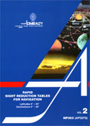
Rapid Sight Reduction Tables for Navigation consist of three volumes of comprehensive tables of altitude and azimuth designed for the rapid reduction of astronomical sights. These volumes were originally entitled SAight Reduction Tables for Air Navigation. The modified title and change in emphasis of the explanation, examples and auxiliary tables are due to theire popularity for marine navigation. However, the United States edition remains unchanged in title and content.
The presend volume (Volume 2) contains tables for integral degrees of declination, for latitudes 0˚-40˚ north and south, and provides for sights of the Sun, Moon and planets; Volume 3 contains similar tables for latitudes 39˚-89˚. These tables are permanent. Volume I contains tables for selected stars for all latitudes, calculated for a specific epoch (2010'0 in the current edition); it is intended for use for about five years, when it will be replaced by a new edition based on a later epoch.


